Natures Of Beauty Headline Animator

Showing posts with label Natures. Show all posts

8/10/12

Rainforest Introduction Location Importance And Images Collection

Introduction:

Tropical rainforests are forests with tall trees, warm climates and lots of rain. In some rainforests it rains more than one inch nearly every day of the year.Rainforests now cover less than 6% of Earth's land surface. Scientists estimate that more than half of all the world's plant and animal species live in tropical rain forests.

A tropical rain forest has more kinds of trees than any other area in the world. Scientists have counted about 100 to 300 species in one 2 1/2-acre (1-hectare) area in South America. Seventy percent of the plants in the rainforest are trees.

About 1/4 of all the medicines we use come from rainforest plants. Curare comes from a tropical vine, and is used as an anesthetic and to relax muscles during surgery. Quinine from the cinchona tree is used to treat malaria. A person with lymphocytic leukemia has a 99% chance that the disease will go into remission because of the rosy periwinkle. More than 1,400 varieties of tropical plants are thought to be potential cures for cancer.

Rainforests Are Found:

The tropical rain forest can be found in three major geographical areas around the world. 
1.  Central America in the the Amazon river basin. 
2.  Africa to Zaire basin with a small area in West Africa  also eastern Madagascar. 
3. Indo Malaysia , west coast of India, Assam, Southeast Asia, New Guinea and Queensland  Australia.


Other countries that have large areas of rainforest include Bolivia, Cameroon, Central African Republic, Ecuador, Gabon, Guyana,Laos, Mexico, Myanmar, Papua New Guinea, Republic of Congo, Suriname, and Venezuela. 

Many Plants And Animals Have In Rainforest Due To:

1.  Climate

Rainforests are located in tropical regions, they receive a lot of sunlight. The sunlight is converted to energy by plants through the process of photosynthesis. Since there is a lot of sunlight, there is a lot of energy in the rainforest. This energy is stored in plant vegetation, which is eaten by animals. The abundance of energy supports an abundance of plant and animal species.

Canopy

The canopy structure of the rainforest provides an abundance of places for plants to grow and animals to live. The canopy offers sources of food, shelter, and hiding places, providing for interaction between different species. For example, there are plants in the canopy called bromeliads that store water in their leaves. Frogs and other animals use these pockets of water for hunting and laying their eggs.

Importance Of The Rainforest:

The beauty, majesty, and timelessness of a primary rainforest are indescribable. It is impossible to capture on film, to describe in words or to explain to those who have never had the awe-inspiring experience of standing in the heart of a primary rainforest.

Rainforests have evolved over millions of years to turn into the incredibly complex environments they are today. Rainforests represent a store of living and breathing renewable natural resources that for eons, by virtue of their richness in both animal and plant species, have contributed a wealth of resources for the survival and well-being of humankind. 


Images:
Rainforest  Image
Rainforest  Image

Rainforest  Picture
Rainforest  Image

Rainforest  Image
Rainforest Image

Desert Introduction Classification And Images Collection

Introduction:

Dry areas created by global circulation patterns contain most of the deserts on the Earth. The deserts of world are not restricted by latitude, longitude, or elevation. They occur from areas close to the poles down to areas near the Equator. The People's Republic of China has both the highest desert, the Qaidam Depression that is 2,600 meters above sea level, and one of the lowest deserts, the Turpan Depression that is 150 meters below sea level. Deserts are not confined to Earth. The atmospheric circulation patterns of other terrestrial planets with gaseous envelopes also depend on the rotation of those planets, the tilts of their axes, their distances from the Sun, and the composition and density of their atmospheres. Except for the poles, the entire surface of Mars is a desert. Venus also may support deserts. The Thar Desert is the Great Indian Desert.

Classification:

Deserts are classified by their geographical location and dominant weather pattern as trade wind, midlatitude, rain shadow, coastal, monsoon, or polar deserts. Former desert areas presently in nonarid environments are paleodeserts, and extraterrestrial deserts exist on other planets.

1. Trade wind deserts:

The trade winds in two belts on the equatorial sides of the Horse Latitudes heat up as they move toward the Equator. These dry winds dissipate cloud cover, allowing more sunlight to heat the land. Most of the major deserts of the world lie in areas crossed by the trade winds. The world's largest desert, the Sahara of North Africa, which has experienced temperatures as high as 57° C, is a trade wind desert. 

2. Midlatitude deserts:

Midlatitude deserts occur between 30° and 50° N. and S., poleward of the subtropical highpressure zones. These deserts are in interior drainage basins far from oceans and have a wide range of annual temperatures. The Sonoran Desert of southwestern North America is a typical midlatitude desert.

3. Rain shadow deserts:

Rain shadow deserts are formed because tall mountain ranges prevent moisture-rich clouds from reaching areas on the lee, or protected side, of the range. As air rises over the mountain, water is precipitated and the air loses its moisture content. A desert is formed in the leeside "shadow" of the range. 

4. Coastal deserts:

Coastal deserts generally are found on the western edges of continents near the Tropics of Cancer and Capricorn. They are affected by cold ocean currents that parallel the coast. Because local wind systems dominate the trade winds, these deserts are less stable than other deserts. Winter fogs, produced by upwelling cold currents, frequently blanket coastal deserts and block solar radiation. Coastal deserts are relatively complex because they are at the juncture of terrestrial, oceanic, and atmospheric systems. A coastal desert, the Atacama of South America, is the Earth's driest desert. In the Atacama, measurable rainfall--1 millimeter or more of rain--may occur as infrequently as once every 5-20 years.
 
5. Monsoon deserts:

Monsoon derived from an Arabic word for "season," refers to a wind system with pronounced seasonal reversal. Monsoons develop in response to temperature variations between continents and oceans. The southeast trade winds of the Indian Ocean, for example, provide heavy summer rains in India as they move onshore. As the monsoon crosses India, it loses moisture on the eastern slopes of the Aravalli Range. The Rajasthan Desert of India and the Thar Desert of Pakistan are parts of a monsoon desert.

6. Polar deserts:

Polar deserts are areas with annual precipitation less than 250 millimeters and a mean temperature during the warmest month of less than 10° C. Polar deserts on the Earth cover nearly 5 million square kilometers and are mostly bedrock or gravel plains. Sand dunes are not prominent features in these deserts, but snow dunes occur commonly in areas where precipitation is locally more abundant. Temperature changes in polar deserts frequently cross the freezing point of water. This "freeze-thaw" alternation forms patterned textures on the ground, as much as 5 meters in diameter.

7. Extraterrestrial deserts:

Mars is the only other planet on which we have identified wind-shaped (eolian) features. Although its surface atmospheric pressure is only about one-hundredth that of Earth, global circulation patterns on Mars have formed a circumpolar sand sea of more than five million square kilometers, an area greater than the Empty Quarter of Saudi Arabia, the largest sand sea on our planet. Martian sand seas consist predominantly of crescent-shaped dunes on plains near the perennial ice cap of the north polar area. Smaller dune fields occupy the floors of many large craters in the polar regions. 


Images:

Desert's Picture
Desert's Image

Desert's Image
Desert's Image

Desert's Wallpaper
Desert's Image

Desert's Picture
Desert's Image

Desert's Image
Desert's Image

Desert's Photo
Desert's Image

8/5/12

Landslide Introduction Precaution And Images Collection

Introduction:

Landslide a frequently occurring natural hazard in the hilly terrains of India and shows preponderance of activity during the monsoon period from July to September and after the snow fall from January to March. The strong earthquakes also cause triggering of landslide particularly in regions marked by critically disposed and unstable slopes. On a rough estimate nearly 15% of India’s landmass or 0.49 million sq km area is prone to landslide hazard. This includes 0.098 million sq km of the North Eastern Region, comprising the Arakan Yoma ranges, and 0.392 million sq km of parts of the Himalaya, Nilgiri, Ranchi Plateau and Eastern & Western Ghats. As many as 20 States of India are affected by different degrees of landslide hazard. Of these, the States of Sikkim and Mizoram have been assessed to be falling under very high to severe hazard classes. Most of the districts of the States of Jammu & Kashmir, Himachal Pradesh, Uttarakhand, Arunachal Pradesh, Nagaland and Manipur come under high to very high landslide hazard classes. In the Peninsular Region, the hilly tracts of States like Karnataka, Andhra Pradesh, Tamil Nadu, Maharashtra, Goa, Madhya Pradesh and Kerala constitute low to moderate hazard prone zones.

Precautions to be taken during landslides:

If inside a building:

  • Stay inside
  • Take cover under a desk, table, or other piece of sturdy furniture
If outdoors:
  • Try and get out of the path of the landslide or mudflow.
  • Run to the nearest high ground in a direction away from the path.
  • If rocks and other debris are approaching, run for the nearest shelter such as a group of trees or a building.
  • If escape is not possible, curl into a tight ball and protect your head.
After Landslide:
  • Stay away from the slide area. There may be danger of additional slides.
  • Check for injured and trapped persons near the slide area. Give first aid if trained.
  • Remember to help your neighbors who may require special assistance--infants, elderly people, and people with disabilities.
  • Listen to a radio or television for the latest emergency information.
  • Stay away from the slide area. There may be danger of additional slides.
  • Check for damaged utility lines. Report any damage to the utility company.
  • Check the building foundation, chimney, and surrounding land for damage.
  • Replant damaged ground as soon as possible since erosion caused by loss of ground cover can lead to flash flooding.
Images:

Landslide Picture
Landslide Image

Landslide Image
 Landslide Image

Landslide Picture
 Landslide Image

 Landslide Wallpaper
Landslide Image

 Landslide Image
Landslide Image

 Landslide Photo
 Landslide Image 

7/28/12

Earthquake Introduction Cause Effect And Images

Introduction:

An earthquake is the result of a sudden release of energy in the Earth's crust that create sseismic waves. Earthquakes are measured using observations from seismometers. The moment magnitude is the most common scale on which earthquakes larger than approximately 5 are reported for the entire globe. The more numerous earthquakes smaller than magnitude 5 reported by national seismological observatories are measured mostly on the local magnitude scale, also referred to as the Richter scale. These two scales are numerically similar over their range of validity. Magnitude 3 or lower earthquakes are mostly almost imperceptible and magnitude 7 and over potentially cause serious damage over large areas, depending on their depth. The largest earthquakes in historic times have been of magnitude slightly over 9, although there is no limit to the possible magnitude. The most recent large earthquake of magnitude 9.0 or larger was a 9.0 magnitude earthquake in Japan in 2011 and it was the largest Japanese earthquake since records began. Intensity of shaking is measured on the modified Mercalli scale.

  Cause:

Earthquakes are caused by tectonic movements in the Earth's crust. The main cause is that when tectonic plates collide one rides over the other causing orogeny earthquakes and volcanoes.The boundaries between moving plates form the largest fault surfaces on Earth. When they stick relative motion between the plates leads to increasing stress. This continues until the stress rises and breaks suddenly allowing sliding over the locked portion of the fault and releasing the stored energy.

Earthquake Effect In As Follows:
1. Shaking and ground rupture
2. Landslides and avalanches
3. Fires
4. Soil liquefaction
5. Tsunami
6. Floods
7.Human impacts

Images:

 Earthquake Photo
Image Of Earthquake

 Earthquake Image
Image Of Earthquake

 Earthquake Photo
Image Of Earthquake

Earthquake Picture
Image Of Earthquake

 Earthquake Image
Image Of Earthquake

 Earthquake Picture
Image Of Earthquake

 Earthquake Picture
Image Of Earthquake

5/28/12

Smoky Mountain Very Beautiful To See Image Gallery

About Smoky Mountain:

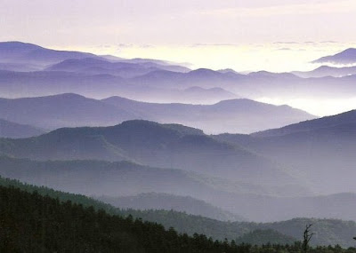
The name "Smoky" comes from the natural fog that often hangs over the range and presents as large smoke plumes from a distance. This fog which is most common in the morning and after rainfall . 

The highest point in the Smokies is Clingmans Dome which rises to an elevation of 6,643 feet. The mountain is the highest in Tennessee and the third highest in the Appalachian range. Clingmans Dome also has the range's highest top graphical prominence at 4,503 feet. Mount Le Conte is the tallest mountain in the range rising 5,301 feet from its base in Gatlinburg to its 6,593-foot .

Images:
Smoky Mountain Photo
 Smoky Mountain's image


Smoky Mountain Image
 Smoky Mountain's image

Smoky Mountain Picture
 Smoky Mountain's image

Smoky Mountain Pic.
 Smoky Mountain's image

Smoky Mountain Image
 Smoky Mountain's image

Smoky Mountain Picture
 Smoky Mountain's image


Smoky Mountain Image
 Smoky Mountain's image


5/20/12

Very Beautiful India's Ponds Nice Picture Collection


Description:

                      A pond is a body of standing water either natural or man made. It is usually smaller than a lake. A wide variety of man made bodies of water are classified as ponds including water gardens designed for aesthetic ornamentation, fish ponds designed for commercial fish breeding and solar ponds designed to store thermal energy. Ponds and lakes are distinguished from streams via current speed. While currents in streams are easily observed, ponds and lakes possess thermally driven microcurrents and moderate wind driven currents. These features distinguish a pond from many other aquatic terrain features, such as stream pools and tide pools.

Images:


Very Beautiful India's Ponds Nice Picture

Very Beautiful India's Ponds Nice Picture

Very Beautiful India's Ponds Nice Picture

Very Beautiful India's Ponds Nice Picture

Very Beautiful India's Ponds Nice Picture

Very Beautiful India's Ponds Nice Picture

Very Beautiful India's Ponds Nice Picture

Very Beautiful India's Ponds Nice Picture

Very Beautiful India's Ponds Nice Picture


Blue Ocean Very Beautiful Nice To See Images Wallpaper


Oceans:    

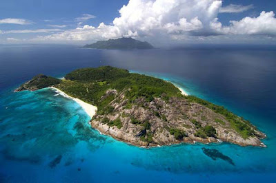
                  An ocean is a major body of saline water, and a principal component of the hydrosphere. Approximately 71% of the Earth's surface (an area of some 361 million square kilometers) is covered by ocean, a continuous body of water that is customarily divided into several principal oceans and smaller seas. More than half of this area is over 3,000 meters (9,800 ft) deep. Average oceanic salinity is around 35 parts per thousand (ppt) (3.5%), and nearly all seawater has a salinity in the range of 30 to 38 ppt. Though generally recognized as several 'separate' oceans, these waters comprise one global, interconnected body of salt water often referred to as the World Ocean or global ocean. This concept of a global ocean as a continuous body of water with relatively free interchange among its parts is of fundamental importance to oceanography.

                   The major oceanic divisions are defined in part by the continents, various archipelagos, and other criteria: these divisions are (in descending order of size) the Pacific Ocean, the Atlantic Ocean, the Indian Ocean, the Southern Ocean and the Arctic Ocean. Smaller regions of the oceans are called seas, gulfs, bays and other names.

Images:

Blue Ocean Very Beautiful  Nice To See Image  Wallpaper

Blue Ocean Very Beautiful  Nice To See Image  Wallpaper

Blue Ocean Very Beautiful  Nice To See Image Wallpaper

Blue Ocean Very Beautiful  Nice To See Images Wallpaper

Blue Ocean Very Beautiful  Nice To See Images Wallpaper

Lakes Very Beautiful Natural Images Wallpaper

Description:

A lake  is a terrain feature or physical feature a body of liquid on the surface of a world that is localized to the bottom of basin  and moves slowly if it moves at all. On Earth a body of water is considered a lake when it is inland not part of the ocean is larger and deeper than a pond and is fed by a river. The only world other than Earth known to harbor lakes is Titan, Saturn's largest moon, which has lakes of ethane, most likely mixed with methane. Natural lakes on Earth are generally found in mountainous areas, rift zones, and areas with ongoing or recent glaciation. Other lakes are found in endorheic basins or along the courses of mature rivers. In some parts of the world there are many lakes because of chaotic drainage patterns left over from the last Ice Age. All lakes are temporary over geologic time scales as they will slowly fill in with sediments or spill out of the basin containing them. 

Images:

Lakes Very Beautiful  Natural Images Wallpaper

Lakes Very Beautiful  Natural Image

Lakes Very Beautiful  Natural Image

Lakes Very Beautiful  Natural Images Wallpaper

Lakes Very Beautiful  Natural Images Wallpaper

Lakes Very Beautiful  Natural Images Wallpaper

Lakes Very Beautiful  Natural Images Wallpaper

Lakes Very Beautiful  Natural Images Wallpaper

Related Posts Plugin for WordPress, Blogger...